
Forney ZIP Code Directory Coverage
Only one Forney ZIP is confirmed here from the official sources examined. The Texas Geospatial Planning Council ZIP list associates 75126 with Forney, and the city’s own Forney public materials use that postal city and ZIP. The Forney research did not locate an authoritative boundary dataset that proves every accepted city label or community overlap within the ZIP. Treat the Forney ZIP code directory as a postal starting point. A particular Forney address still needs a USPS check, then a separate city-limit or ETJ check.
| ZIP | Areas Covered | Post Office | Notes |
|---|---|---|---|
| 75126 | Forney is the verified city association in USPS and Texas geospatial materials; a complete official Forney community or boundary list was not located | USPS Forney Post Office, 102 E Broad St, Forney, TX 75126-9998 | Forney postal starting point only. Check Kaufman GIS and Forney ArcGIS for Forney city limits, ETJ, and nearby unincorporated areas. |
No second ZIP serving the incorporated City of Forney was confirmed in the sources inspected. That is not proof that every nearby Forney address uses 75126, or that no other postal arrangement exists nearby. Verify an actual Forney mailing address with USPS before using a ZIP code in a Forney records request or a Forney parcel search.
Forney ZIP Code Directory Postal Check
The USPS location record for the Forney Post Office identifies the office at 102 E Broad St with ZIP 75126-9998. That Forney source supports postal-service context, not the edges of a municipal boundary. Forney postal addressing and city government jurisdiction are maintained for different purposes. Keep the Forney source and date with the address result, especially when a Forney address falls near a boundary.
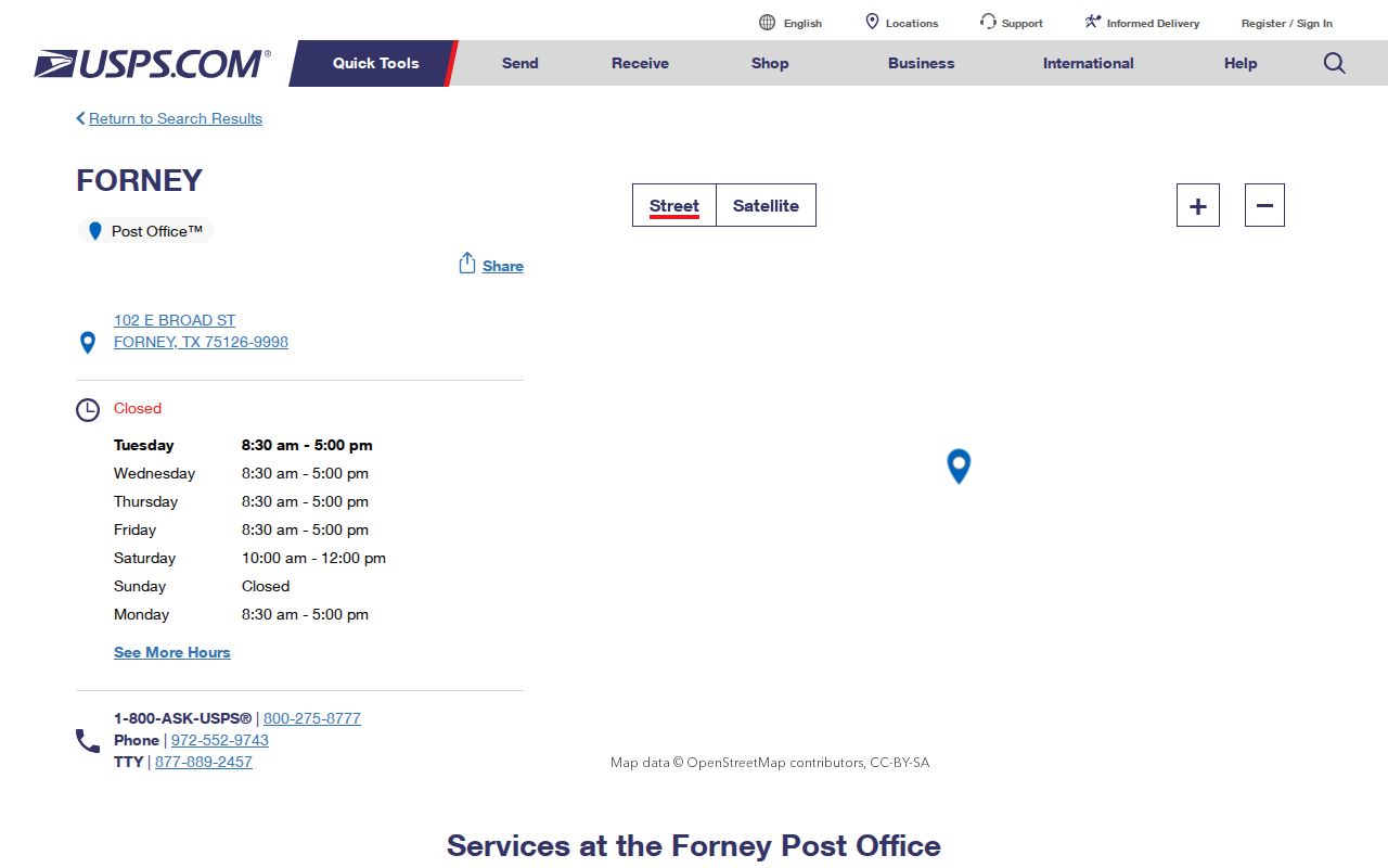
The USPS result is most useful as the first confirmation in a Forney ZIP code directory search. After it is checked, compare the same full Forney address with county GIS and the city’s ArcGIS layers if the record request depends on whether it is inside Forney or its ETJ.
A ZIP+4 is a more detailed postal routing addition to a base ZIP. A PO-box ZIP serves boxes, a unique ZIP can be assigned to an organization, and a carrier route is a delivery grouping. These terms describe postal formats in general; they do not claim that Forney has any particular special ZIP arrangement beyond the verified Forney 75126 information above.
Forney ZIP Code Directory Boundary Check
Forney postal, municipal, and parcel systems overlap without matching exactly. USPS establishes a Forney delivery label. Kaufman County GIS shows Forney jurisdiction, city-limit or ETJ context, precinct, neighborhood, school district, voting location, and FEMA flood layers. Forney ArcGIS public services include Forney city-limit, ETJ, and zoning layers. Use a Forney ZIP to start, then use the map services to test the jurisdiction before describing a public city record as applicable to the Forney address.
The county GIS is a Forney address or parcel-ID map tool, and its layers are maintained and updated. Its Forney parcel polygon supplies geography, not a full record of every person associated with a location. The Forney city service directory is also a map-resource layer rather than a name search. A Forney map boundary can answer where the parcel sits; the responsible office answers what record exists and what part of it is public.
Boundary note. A Forney postal city name or ZIP does not prove city-limit status. Confirm the address in Kaufman County GIS and the Forney city-limit or ETJ layer before relying on a municipal route.
Find Records in a Forney ZIP Code
A Forney ZIP-centered search becomes reliable only after it turns into a Forney address or parcel search. This order retains the useful postal clue without implying that county records can be filtered by ZIP. It also avoids a broad Forney name list, which the reviewed local tools did not provide for this purpose.
- Use USPS ZIP Lookup to confirm the postal form for the full Forney address and save the date checked.
- Search the same Forney address or parcel ID in Kaufman County GIS and turn on the city-limit, ETJ, and jurisdiction layers relevant to the question.
- Open KCAD eSearch with the Forney street number and street name, or use a property ID or geographic ID from the map.
- For a recorded Forney transfer, carry the legal description or instrument clue to TexasFile or the Kaufman County Clerk. For a municipal record, send a focused Forney MyGov or Public Information Act request for an existing dated record.
Once a ZIP has narrowed the area to a particular street, the Forney street directory has the fuller address-to-parcel workflow. That separate route is better for walking a named street or comparing deed clues than a ZIP alone.
Forney ZIP Code Directory KCAD Fields
KCAD does not show a visible ZIP field in the inspected interface. Its eSearch works through Forney address, owner, and advanced appraisal fields instead. That Forney limitation matters. Do not claim that a Forney appraisal search returns all records within 75126. Convert the postal result to a Forney address, property ID, geographic ID, owner, or subdivision clue, then search the fields the interface actually exposes.
| KCAD Mode | Visible Search Fields | ZIP Code Directory Use |
|---|---|---|
| By Owner | Owner Name, with last-name/first-name hint | Use after an address or deed produces an owner lead |
| Address | Street Number and Street Name | Best first KCAD route after USPS confirms the address form |
| Advanced | Property ID, geographic ID, subdivision, abstract, tax year, neighborhood, and other appraisal controls | Use a parcel or subdivision clue, not an assumed ZIP filter |
| Parcel card | Situs, legal description, owner display, values, and deed-history clues | Compare the resulting parcel with GIS and recorded-index information |
Forney’s useful normalization rule is simple: search the street number and street name first, leaving out prefixes, suffixes, and unit numbers. Inspect the returned parcel card for the exact situs and legal detail. A mailing address may differ from the situs, so it should not be treated as proof that someone is currently at the parcel.
Forney ZIP Code Directory Address Keys
County 911 Addressing connects a physical address to parcel evidence. Its application materials call for a recorded deed and site plan showing the structure and driveway, and the county allows a CAD or GIS map as part of the site-plan material. That process supports address assignment and parcel continuity, not a directory of people. Development Services and 911 Addressing are counter routes when a current map result needs an official process or context.
Keep the raw address and the normalized form together with the parcel ID, geographic ID, legal description, map date, and city or ETJ outcome. This small record trail makes a ZIP code directory search reproducible. It also helps when an older map uses a street or locality form that differs from today’s postal address.
Note: A county GIS layer may change through maintenance, so record its layer name and inspection date with any address conclusion.
Forney ZIP Code Directory Map Context
For historical geography, the 1896 Library of Congress Sanborn map, the 1919 University of Texas Sanborn collection, and the 1990 Texas State Library and Archives Map of Forney offer dated street and built-environment context. The older material can help identify a street, road, rail line, or water feature across time. It cannot establish a present postal ZIP or provide a current household record.
Brooklyn and railroad-era Forney language can appear in older research. Search those locality terms in newspapers, maps, and older directory or census catalogs when a modern address produces no historical lead. Do not present Brooklyn as a current postal alternative without a source. The city’s growth and service layers should be checked through the current county and city maps, not inferred from historic sheets.
Forney ZIP Code Directory Privacy Limits
A ZIP code does not open protected information. Voter information has confidential identifiers and protected-address procedures, and Texas Address Confidentiality Program participants can use substitute addresses. County map and appraisal results also cannot reliably establish every household member, current presence, utility customer, or delivery recipient. Do not infer a hidden location from an adjoining parcel, mailing address, or map layer.
When an existing city or county record is needed, a written Texas Public Information Act request can be sent through an approved channel. Name the known address, record type, and date range. The Act covers existing records; it does not require staff to create a ZIP-based list or answer an open-ended question. Sensitive portions may be withheld or redacted under the applicable law.
Lawful use. Use address and ZIP research for personal, family-history, property, or civic questions. Do not use a postal or map clue to stalk, harass, intimidate, or harm any person.
Forney ZIP Code Directory Access Routes
The practical channels are distinct: USPS location and ZIP Lookup for postal delivery context; Kaufman County GIS and Forney ArcGIS for geographic layers; KCAD for parcel appraisal fields; and the County Clerk or TexasFile for recorded-document research. City Community Development and county 911 Addressing can answer focused process questions at the counter or by phone. City and county public-information routes can receive a request for an existing boundary, addressing, permit, or GIS record with a specified date or version.
For older street or map research, use TSLAC, the Library of Congress, and University of Texas collections. Those archives provide historical context while the current custodian resolves the present record. Each route answers a different part of the question, which is why the Forney ZIP code directory should not be treated as one all-purpose location list.