
Walking the Forney Street Directory
A Forney street-by-street search works best when the address is the stable key. The public chain begins with the normalized Forney address in KCAD, then uses the GIS to establish the Forney parcel and jurisdiction, and only then moves to a recorded-instrument search. This sequence distinguishes an appraisal lead for that Forney parcel from a deed record. It also prevents a Forney city assumption when the parcel may instead be in the ETJ or another county jurisdiction.
The ownership record for a Forney parcel and current residence are not the same conclusion. A Forney parcel card may identify an owner or a tax mailing address. A deed index for a Forney parcel may identify parties to an instrument. Neither creates a complete Forney household list. The later steps add time, map, and document context while keeping each result tied to its actual custodian.
- Save the Forney address exactly as received, then make a normalized version using only street number and street name for the KCAD search.
- Open KCAD for the Forney address, then record the property ID, geographic ID, situs address, legal description, and any deed-history clue.
- Search the full Forney address or parcel ID in Kaufman County GIS, then turn on the city limit, ETJ, parcel, precinct, neighborhood, school, voting, or flood layers that answer the question.
- Use the Forney owner display or legal description in TexasFile, moving from the current grantee toward earlier grantors through recorded instruments.
- Use state voter channels only for the lawful individual or formal data route for Forney records, because no verified Kaufman County street search exists. For older Forney residents, seek a cataloged historical source rather than assuming a local criss-cross run exists.
Note: Record the map date and layer names with each Forney street search because GIS data are maintained and updated.
Forney Street Address Normalization
Normalize the Forney address before trying a name. Preserve the original Forney written address in the notes, then create the KCAD form for that Forney address with Street Number and Street Name. KCAD's address advice for Forney searches is specific: omit prefixes, suffixes, and unit numbers. That small change is often the difference between a failed search and a parcel result. Once the card opens, use the exact situs and legal-description fields for the Forney parcel in the remaining record trail.
Do not collapse the Forney record keys into one label. The situs address for a Forney parcel is the taxable property location. A Forney mailing address is where tax correspondence is sent. A legal description identifies the Forney parcel in a recorded format. Property ID and geographic ID are system keys. Keeping all of them prevents a Forney address-only search from drifting when a subdivision, street form, or owner name is abbreviated.
- Parcel
- A mapped property unit linked to appraisal and legal-description records.
- Situs address
- The property location used for appraisal, which can differ from the tax mailing address.
- Plat
- A recorded map that can show lots, blocks, and subdivision layout.
- Criss-cross directory
- An address-first historical directory. No local title or run was verified in the research.
Forney Street Parcel Cards
KCAD eSearch for Forney properties is the main address-keyed screen for the Forney street directory. Its By Owner tab accepts Owner Name. Its Address tab exposes Street Number and Street Name. Advanced expands the search with property and appraisal fields that narrow a Forney result. The public parcel card for a Forney address can then show owner display, mailing and situs addresses, legal description, subdivision or abstract clues, values, exemptions, land and improvement data, and deed-history references. The sample card also displayed value history for 2018-2026.
| KCAD mode | Visible fields | Forney street-search note |
|---|---|---|
| By Owner | Owner Name text | Try a Forney name in comma or space order where needed. |
| Address | Street Number; Street Name | Omit prefix, suffix, and unit in a Forney address. |
| Advanced | Abstract, mobile-home park, Property ID, Property Type, Agent ID, Protest Status, informal date, DBA, Street Name, Subdivision, Condo, Owner ID, Geographic ID, Tax Year, Neighborhood, hearing date, board members, formal date | Property Type and Tax Year options for Forney searches were not captured. |
| Actions | Tabs, Search, help and terms links | No visible Forney ZIP field was found in the inspected modes. |
The official KCAD parcel-card sample shows the record fields used to connect a Forney street to appraisal and deed-history clues.
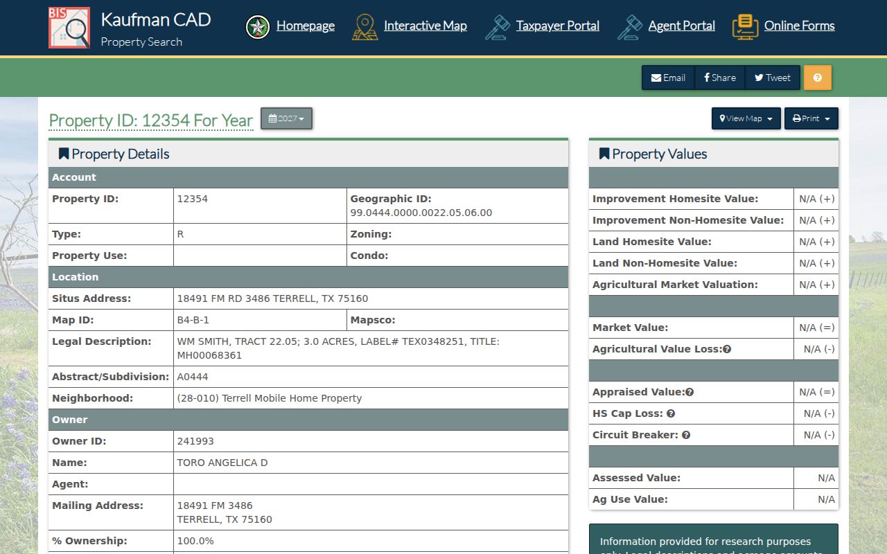
The sample confirms the practical Forney distinction between owner, situs, legal description, values, and deed-history entries on a parcel card.
Forney Street GIS Layers
Kaufman County GIS accepts a full Forney address or parcel ID. Once the target Forney parcel is found, use the layer toggles deliberately. City limit, ETJ, jurisdiction, precinct, neighborhood, school district, voting location, and FEMA flood layers describe the geographic setting of a Forney street. ZIP 75126 is only a postal starting point for Forney, so the city-limit and ETJ layers should settle a Forney municipal boundary question before a permit or records request is made.
For a Forney street segment, click the target polygon, copy the parcel or legal-description clue, then pan to adjoining polygons and repeat the parcel-card method. The research did not verify a specialized radius, measure, or automated neighbor-export control. The documented Forney method is map browse. Forney ArcGIS public services can provide city-limit, ETJ, zoning, and utility context, but it is a technical map-service directory rather than a resident-name tool.
Forney Street Deed Trails
TexasFile is the practical recorded-index route for a Forney parcel after a card produces a current owner or legal-description clue. Search the current owner shown for the Forney parcel as a grantee, identify the seller or grantor, and repeat backward. Instrument date, type, book or page or number, and subdivision, lot, block, abstract, or survey details are more stable than a Forney street label. A CAD deed-history row tied to a Forney address is a lead, not a replacement for the recorded instrument.
TexasFile reports a Kaufman full index used for Forney research from 1847-10-18 through 2026-08-24 and plat coverage from 1881-08-16 through 2026-03-26. The free index and preview for Forney research can identify the record before an image is considered. For an earlier Forney fallback, the TSLAC Kaufman County guide lists deed microfilm for 1849-1911 and grantor-grantee index ranges from 1846-1860 through 1900-1902. The guide notes no Volume A or E in its listed deed series.
The TSLAC Kaufman County microfilm guide for Forney research documents that pre-digital fallback and its catalog gaps.
Forney Street Directory Records
Forney address-keyed sources have different strengths. The parcel card for a Forney address is the appraisal starting point. GIS supplies Forney map context. TexasFile leads to recorded instruments for a Forney parcel. Forney municipal records can document a known permit, inspection, or addressing process if a public portion exists. Voter channels are more limited than a street directory because no verified county street-name search was found. The table keeps those routes separate.
| Address record | Forney street connection | Custodian | Access and limit |
|---|---|---|---|
| KCAD record for a Forney parcel | Owner display, situs, mailing address, legal description, values, deed-history clues | Kaufman CAD | Forney address, owner, or ID search; appraisal lead. |
| Kaufman GIS for Forney | Parcel polygon, jurisdiction, ETJ, precinct, neighborhood, school, voting, flood layers | Kaufman County | Full Forney address or PID search; no verified automated export. |
| TexasFile for Forney records | Instrument parties, dates, legal descriptions, book or page or number | Kaufman County Clerk | Free index for Forney research; document images may cost. |
| Forney MyGov and city request route | Existing permit, plan-review, inspection, or certificate records by address where public | City of Forney | Ask for a described existing public portion. |
| 911 address route for Forney | Address assignment and parcel-continuity documents | Kaufman County Development Services | Not a list of people. |
Use a Forney property ID or legal description to join these sources, rather than trusting a street label alone. A Forney mailing address can be a helpful contact clue, but it is not proof that the named owner is at the situs. For one-person verification, the Forney record-specific methods on the resident lookup page are more appropriate than expanding a street trail.
Forney Street Voter Limits
The Texas MVP tool is the county-recommended route for an individual registration check, but its exact fields were not captured in this research. Kaufman County did not expose a public street-name search. The official voter-data request forms are a separate state process for an existing data set, with forms, delivery methods, and restrictions. They should not be described as a routine way to assemble a street roster.
Texas public-information rules distinguish limited public voter information from confidential Social Security, driver-license, DPS, and protected-address data. Protected voters and Address Confidentiality Program participants can have an address obscured or replaced. A public participation record never reveals how someone voted, and Texas does not register voters by party.
Note: A protected or substitute address is not a gap to solve with map layers, nearby parcels, or an address-linked search.
Forney Addressing Records
The Forney residential building route directs users to MyGov for permit, plan-review, payment, document attachment, inspection, and status workflows. It can help establish whether an address has a particular municipal record, but a permit applicant is not automatically an owner or a present household member. No official city code-enforcement case lookup was located during research, so do not imply one exists. Use the city's public-information intake for a described existing record and expect sensitive information to be redacted where required.
The certificate-of-occupancy process is a separate city route with intended-use, water-service, emergency-contact, and fire-marshal inspection information. Ask for a severable public portion through the custodian rather than assuming every field in a modern packet is open.
Kaufman County 911 Addressing supplies a different address record. An application requires a completed form, recorded deed, and site plan showing the structure and driveway. A recent survey is optional, and the county suggests using a CAD or GIS map to draw the structure and driveway route. That makes the application useful address-assignment context, not a street directory of people.
The Kaufman County 911 Addressing page shows the required document and map steps.
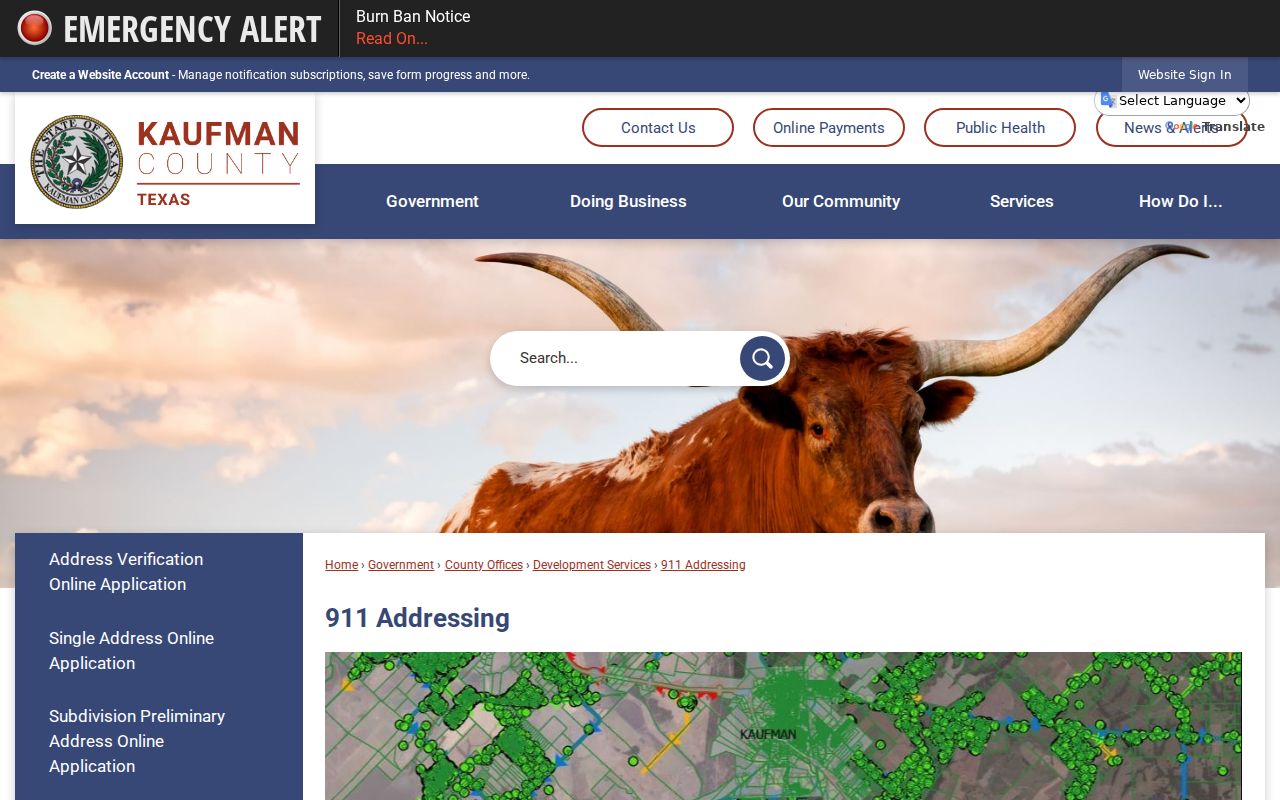
The county instructions reinforce the connection among a recorded deed, a site plan, and a mapped address, without turning the application into a person search.
Forney Street Map Trail
For an older street label or building clue, compare map dates before assuming that a present-day address will appear in an early source. The Library of Congress catalogs an August 1896 Forney Sanborn map with three sheets. UT surfaced multiple 1919 Sanborn sheets, and a 1990 TSLAC map shows streets, roads, railroads, water lines, hydrants, fire stations, and water-system features. These are built-environment sources, not lists of residents.
Older research may also need the locality term Brooklyn. Official history places a Brooklyn village in the area and describes a railroad-era Forney rename or relocation context around 1873. Search Brooklyn, Forney, precinct, railroad, and legal-description variants alongside the relevant date. That approach can bridge a map clue to the County Clerk index or to library and newspaper material without claiming that a modern street name has always been in use.
Forney Street Search Limits
A Forney street directory cannot reliably show every person at an address, every mailing recipient, utility customer, or delivery recipient. An owner may use a different mailing address. A property can be held by a business, trust, or other entity. A municipal document may name someone connected to an application without establishing ownership or present residence. DMV address information is restricted under the federal Driver's Privacy Protection Act framework.
When an online source does not answer the record question, use the documented channel for that source: KCAD, TexasFile, county GIS, Forney ArcGIS, city MyGov, and SOS routes online; KCAD, County Clerk, Development Services or 911, and the City Hall Annex at the counter; and the Clerk, CAD, and Community Development phone, mail, email, or public-information routes. Kaufman County Library, TSLAC, UT, LOC, and UNT are the archival chain for earlier street context. A Texas Public Information Act request must seek an existing record, not a new list.