
Forney Neighbors by Block Source
The immediate block around a Forney address can be studied through Forney parcel polygons, appraisal clues, recorded-document indexes, and local community records. Each Forney source answers a narrow question. The map identifies surrounding Forney parcels. KCAD displays Forney appraisal and parcel fields. TexasFile points to recorded Forney parties and legal descriptions. Forney city channels can identify whether an existing municipal document may be requested. Neither a Forney parcel owner nor a filing party necessarily proves that a person is currently present at the address.
| Source | What It Shows About a Block | Access |
|---|---|---|
| Kaufman GIS | Forney parcel polygons, jurisdiction, precinct, neighborhood, school, voting, flood, and ETJ layers | Forney address or PID search and map browse; no verified automated neighbor export |
| Forney ArcGIS | Forney city limits, ETJ, zoning, public map services, and water-utility service context | Forney technical service directory, not a name lookup |
| KCAD | Forney parcel owner display, situs and mailing fields, legal description, values, and deed-history clues | Forney address, ID, or owner search; no visible ZIP field; appraisal source |
| TexasFile | Forney recorded-index parties, dates, legal descriptions, and instrument or book references | Free Forney index or preview; images may cost; no sample row was opened |
| Texas HOA search | Forney association and management-certificate contacts | No public Forney membership roster located |
| City MyGov or PIA | Forney public permit, certificate, or inspection documents tied to an address where available | Some modern Forney personal fields can be restricted |
| SOS voter channels | Lawful Forney individual or defined public-file fields and precinct context | Protected Forney addresses and identifiers are restricted; no county street search verified |
Use the Forney address and parcel identifier as the organizing keys. A Forney title or mailing field may be a research clue, but it does not establish a complete block roster. The result is stronger when it distinguishes an exact Forney official record from an index lead or an unresolved name match.
Map a Forney Block Before Names
Kaufman County’s GIS method for Forney is map-first. It accepts a full Forney address or parcel ID and lets the researcher turn layers on and off. The inspected county material did not document a radius or select tool, so a claim of an automated all-Forney-neighbors export would be inaccurate. Browse the adjoining Forney polygons manually, preserve each parcel or legal-description clue, and only then open the appraisal or recorded-index route that fits the specific question.
- Open the Kaufman County GIS web app and search the complete Forney address or parcel ID.
- Turn on the Forney parcel, jurisdiction, city-limit or ETJ, precinct, neighborhood, school, voting, and flood layers that matter to the block question. Record the layer names and date.
- Click the target Forney polygon, then browse the immediately adjoining polygons. Write down the parcel ID or legal-description clue before searching Forney names.
- Use KCAD by Forney property ID or geographic ID, then use a relevant party or legal clue in TexasFile. Stop where the record only supplies a protected or uncertain lead.
This process keeps Forney neighbors tied to adjacent Forney parcels rather than a guessed radius. For a full Forney named-street record chain, use the Forney street directory after the Forney block question has become a street question.
Forney Neighbors Parcel Keys
Forney parcel IDs, geographic IDs, legal descriptions, subdivision names, and recorded instrument numbers are more stable research keys than a surname alone. KCAD eSearch accepts a Forney street number and street name, owner name, property ID, geographic ID, subdivision, and additional appraisal fields. Its Forney address guidance says to omit prefixes, suffixes, and unit numbers. The Forney parcel card can display a situs, mailing address, legal description, value fields, and deed-history clues.
The Forney situs is the taxable property location. A Forney tax mailing address is where correspondence goes, and it can differ from the situs. A homestead display can be a Forney owner-presence clue, but it is not conclusive and not every exemption is shown online. TexasFile’s Forney recorded index is the next step when a deed-history clue needs corroboration. Its party, date, legal, instrument, and book or page modes help distinguish a recorded Forney transfer from a general name match.
- Parcel ID
- An identifier used by the appraisal and map systems to distinguish a parcel.
- Legal description
- The lot, block, tract, subdivision, abstract, or survey wording that identifies land in recorded documents.
- Situs
- The physical taxable-property location shown in an appraisal record.
- Instrument number
- The recorded-document reference used to locate a particular filing in a deed index.
Forney Neighborhood Certificate Contacts
Texas maintains an official HOA management-certificate search that can be filtered by HOA name, county, city, ZIP, and association type. The records examined under Forney and Kaufman filters included the Forney associations listed below. A Forney management certificate may identify an association or management contact and corporate information. It is not a Forney membership roster, resident list, or proof that every nearby parcel is within an association’s coverage.
| Forney or Kaufman Search Result | Official Search Use | Careful Reading |
|---|---|---|
| Amrita KC | Find management-certificate document | Check the certificate and date before relying on a contact |
| Lynx Hollow HOA | Find management-certificate document | Not a member directory |
| Las Lomas West HOA | Find management-certificate document | Not proof of parcel coverage |
| Brooklyn Village HOA variants | Find management-certificate document | Confirm the exact association name |
| Clements Ranch HOA | Find management-certificate document | Use association contact for bylaws or meeting rules |
| Walden Pond Residential HOA | Find management-certificate document | Do not infer member status |
| Skyline Estates Phase II HOA | Find management-certificate document | Check the particular certificate |
| Shamrock Ridge HOA | Find management-certificate document | Not a personal contact list |
| Devonshire Residential Association | Find management-certificate document | Confirm current boundary information separately |
The official management-certificate results illustrate the search route for community context in a Forney neighbors inquiry.
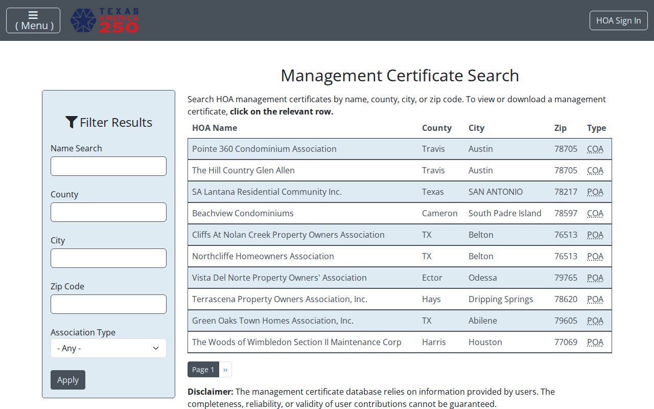
Use a Forney association-management contact to ask about published bylaws or meeting rules, not for personal member data. The research did not locate an official public membership directory for Forney neighborhood associations or civic clubs.
Forney Neighbors Official Record Limits
Official Forney records and commercial neighbor-finding categories serve different purposes. An official Forney record identifies its custodian, source date, and statutory limits. A commercial category may combine or repeat Forney records, but it may not show its source date or matching logic clearly. Neither category is a reason to treat a Forney name and a map location as a complete personal profile. Compare a result against the public record that actually supports the narrow question.
| Source Type | Useful Block Question | Limit to Preserve |
|---|---|---|
| County GIS and KCAD | Which parcel is adjacent and what appraisal key describes it? | Map and appraisal data do not prove every current person at an address |
| County Clerk and TexasFile | Which recorded parties and legal descriptions appear in a transfer? | A recorded filing is not a complete current-person list |
| Commercial neighbor-finding category | May suggest a source to verify | Accuracy, source date, cost, and matching methods vary |
Texas voter data has additional boundaries. The Secretary of State MVP handles individual registration checks, but the exact fields were not independently rendered. Kaufman County did not expose a county street-name search. The public-file request process is separate and subject to forms, delivery rules, and confidentiality restrictions. Election participation does not reveal a ballot choice, and Texas has no party-registration field.
Forney Neighbors Municipal Record Routes
Forney city records can add property context without becoming a personal directory. MyGov is the city route for permits, plan review, payment, document attachments, status, and inspections. Ask whether a defined public record exists for an address, rather than treating an application as a complete ownership history. The Texas Public Information Act is the route for a narrowly described existing city or county record, such as a dated permit, certificate, 911 addressing, or map-layer record.
The City of Forney staff directory identifies current department contacts, including city secretary, community development, building inspection, neighborhood services, planning, and police records.
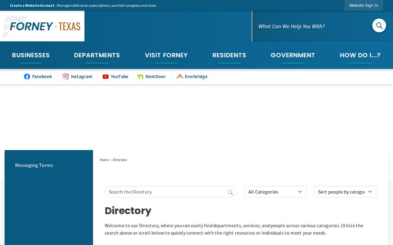
Use the department directory to reach the office that holds the record type, then include the address, date range, and parcel or legal-description detail available. Current staff listings are contact routes, not historical personal records.
County 911 Addressing requires a recorded deed and site plan showing the structure and driveway, using a CAD or GIS map when appropriate. That process is evidence of address assignment and parcel continuity, not a list of the people associated with the location.
Forney Neighbors Map Layer Context
Forney neighbors research becomes more useful when civic layers are kept separate from personal data. Kaufman GIS offers precinct, neighborhood, school district, voting location, FEMA flood, city ETJ, and jurisdiction layers. Forney ArcGIS adds city limits, ETJ, zoning, public services, and water-service context. These layers describe boundaries and services. They do not identify an entire household or establish a person’s current location.
Older map sources add a different kind of context. The 1896 Library of Congress Sanborn map, the 1919 University of Texas Sanborn collection, and the 1990 Texas State Library and Archives Forney map can document streets, rail lines, water features, and built form at specific dates. Brooklyn and railroad-era Forney wording may help in historic newspaper and map searches. It should be treated as a historical locality clue, not as a present map label without current verification.
Forney Neighbor Lookup Privacy Boundaries
What the map and records cannot show is as important as what they can. They cannot reliably identify every household member, current presence, utility customer, delivery recipient, or person connected to a permit. A parcel owner may use another mailing address, and an entity or trust may appear in a record. Driver-license address information is restricted. Protected voters and Address Confidentiality Program participants may have address data hidden or replaced.
Lawful use. Use information about Forney neighbors for personal, civic, family-history, or property context. Never use a map, address clue, directory result, or protected-program artifact to stalk, harass, intimidate, or harm anyone.
Texas Penal Code sections 42.07 and 42.072 address harassment and stalking conduct. Do not guess a protected location from nearby parcels or map layers. For a correction, redaction, or confidentiality question, contact the specific custodian, SOS voter procedure, Texas Attorney General Address Confidentiality Program, or another documented official route.
Forney Neighbors Access Channels
Online research starts with KCAD, Kaufman GIS, Forney ArcGIS, TexasFile, official HOA certificates, MyGov, and the authorized SOS channels. In person, use KCAD, the County Clerk, Development Services or 911 Addressing, the Forney Annex, or City Clerk and public-information offices. Focus the request on one address, parcel, record type, and date range. That makes it possible for the custodian to locate an existing record and apply any necessary redaction.
Phone, mail, and email routes include the County Clerk, CAD, Community Development, city public-information intake, and association contacts shown on an official certificate. Kaufman County Library, TSLAC, UT, the Library of Congress, and UNT are the archive routes for maps, older directory materials, newspapers, and context. These channels fill different roles, so a careful block trail records both the source and the access limit.